Anak Krakatau

Crater summit Anak Krakatau.

Anak Krakatau eruption

Strombolian eruption of Anak Krakatau.

Anak Krakatau eruption

Explosive eruption of Anak Krakatau

Ujung Kulon National Park

The Javan Rhinoceros Sondaicus.

Cigenter River Ujung Kulon National Park

Canoeing along Cigenter River searching for The Javan Rhinoceros.

Baduy Tribe

Group of Baduy Tribe traveling on bare foot.

Putri Carita Fall or Little Green Canyon Banten

One of beautiful and excotic waterfall nearby Carita Beach.

Krakatau Camp Tour

Explore Krakatau for two days 1 night by night in the tent.

Krakatau underwater

Explore underwater around Krakatau.

Krakatau and Island surrounding

Walking along the beach while seeing an amazing view.

Anak Krakatau

Climbing through the desert to get outer rim.

1883 eruption of Krakatoa

Title: De uitbarsting van de Krakatau Shelfmark: KITLV 5888 Subject (topical): Volcanic Eruptions Volcanoes Subject (geographic): Indonesia Krakatau Lampung Selatan Note: Foto van een foto. Language: No linguistic content Country: No place, unknown, or undetermined Published: 1883

The 1883 eruption of Krakatoa (Indonesian: Letusan Krakatau 1883) in the Sunda Strait occurred from 20 May until 21 October 1883, peaking in the late morning hours of 27 August when over 70% of the island of Krakatoa and its surrounding archipelago were destroyed as it collapsed into a caldera.

The eruption was one of the deadliest and most destructive volcanic events in recorded history. The explosion was heard 3,110 kilometres (1,930 mi) away in Perth, Western Australia, and Rodrigues near Mauritius, 4,800 kilometres (3,000 mi) away. The acoustic pressure wave circled the globe more than three times.: 63  At least 36,417 deaths are attributed to the eruption and the tsunamis it created.
Significant additional effects were felt worldwide in the days and weeks after the volcano's eruption. Additional seismic activity was reported until February 1884, but any reports after October 1883 were dismissed by Rogier Verbeek's subsequent investigation into the eruption.

Early phase
n the years before the 1883 eruption, seismic activity around the Krakatoa volcano was intense, with earthquakes felt as far away as Australia. Beginning on 20 May 1883, steam venting began to occur regularly from Perboewatan, the northernmost of the island's three cones. Eruptions of ash reached an estimated altitude of 6 km (20,000 ft), and explosions could be heard in Batavia (Jakarta) 160 km (100 mi) away.
Eruptions at Krakatoa started again around 16 June, with loud explosions and a thick black cloud covering the islands for five days. On 24 June, a prevailing east wind cleared the cloud, and two ash columns could be seen issuing from Krakatoa. The seat of the eruption is believed to have been a new vent or vents that formed between Perboewatan and Danan. The violence of the ongoing eruptions caused tides in the vicinity to be unusually high, and ships at anchor had to be moored with chains. Earthquakes were felt at Anyer, Banten, and ships began to report large pumice masses to the west in the Indian Ocean.
In early August, a Dutch topographical engineer, Captain H. J. G. Ferzenaar, investigated the Krakatoa islands. He noted three major ash columns (the newer from Danan), which obscured the western part of the island, and steam plumes from at least eleven other vents, mostly between Danan and Rakata. When he landed, he noted an ash layer about 0.5 m (1 ft 8 in) thick and the destruction of all vegetation, leaving only tree stumps. He advised against any further landings

Climactic phase
By 25 August, the Krakatoa eruptions intensified. At about 1:00 pm on 26 August, the volcano entered its paroxysmal phase. By 2:00 pm, a black ash cloud could be seen 27 km (17 mi) high. At this point, the eruption was almost continuous, and explosions could be heard every ten minutes. Ships within 20 km (12 mi) of the volcano reported heavy ash fall, with pieces of hot pumice up to 10 cm (4 in) in diameter landing on their decks. Between 7:00 pm and 8:00 pm, a small tsunami hit the shores of Java and Sumatra, 40 km (25 mi) away.
On 27 August, four enormous explosions occurred, which marked the climax of the eruption. At 5:30 am, the first explosion was at Perboewatan, triggering a tsunami heading to Telok Betong, now known as Bandar Lampung. At 6:44 am, Krakatoa exploded again at Danan, with the resulting tsunami propagating eastward and westward. The third and largest explosion, at 10:02 am, was so violent that it was heard 3,110 km (1,930 mi) away in Perth, Western Australia, and the Indian Ocean island of Rodrigues near Mauritius, 4,800 km (3,000 mi) away, where the blast was thought to have been cannon fire from a nearby ship. The third explosion has been reported as the loudest sound in history. The loudness of the blast heard 160 km (100 mi) from the volcano has been calculated to have been 180 dB.[9] Each explosion was accompanied by tsunamis estimated to have been over 30 metres (98 feet) high in places. A large area of the Sunda Strait and places on the Sumatran coast were affected by pyroclastic flows from the volcano. Material shout out of the volcano at 2,575 kilometres per hour (715 metres per second).[10] The energy released from the explosion has been estimated to be equal to about 200 megatonnes of TNT (840 petajoules), roughly four times as powerful as the Tsar Bomba, the most powerful thermonuclear weapon ever detonated. This makes it one of the most powerful explosions in recorded history. At 10:41 am, a landslide tore off half of Rakata volcano, along with the remainder of the island to the north of Rakata, causing the final explosion.

Pressure wave
The pressure wave generated by the colossal third explosion radiated out from Krakatoa at 1,086 km/h (675 mph). The eruption is estimated to have reached 180 dB, loud enough to be heard 5,000 kilometres (3,100 mi) away.[12]: 248  It was so powerful that it ruptured the eardrums of sailors on RMS Norham Castle of the Castle Line which was hove to off Sumatra,   and caused a spike of more than 8.5 kilopascals (2.5 inHg) in the pressure gauge attached to a gasometer in the Batavia gasworks 160 km (100 miles) away, sending it off the scale.
The pressure wave was recorded on barographs worldwide. Several barographs recorded the wave seven times over five days: four times with the wave travelling away from the volcano to its antipodal point and three times travelling back to the volcano.[4]: 63  Hence, the wave rounded the globe three and a half times. Ash was propelled to an estimated height of 80 km (50 mi).
The eruptions diminished rapidly after that point, and Krakatoa was silent by the morning of 28 August. Small eruptions, mostly of mud, continued into October 1883. By then, less than 30% of the original island remained.

Effects
The combination of pyroclastic flows, volcanic ash, and tsunamis associated with the Krakatoa eruptions had disastrous regional consequences. Some land in Banten, approximately 80 km south, was never repopulated; it reverted to jungle and is now the Ujung Kulon National Park. The official death toll recorded by the Dutch authorities was 36,417

"The Burning Ashes of Ketimbang"
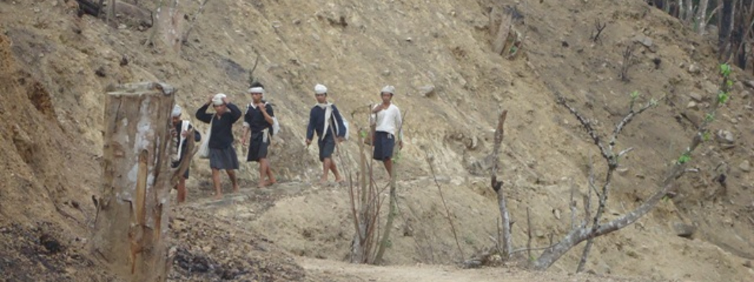
Verbeek and others believe that the final major Krakatoa eruption was a lateral blast, or pyroclastic surge. Around noon on 27 August 1883, a rain of hot ash fell around Ketimbang (now Katibung in Lampung Province) in Sumatra. Approximately 1,000 people were killed in Sumatra; there were no survivors from the 3,000 people on the island of Sebesi. There are numerous reports of groups of human skeletons floating across the Indian Ocean on rafts of volcanic pumice and washing up on the east coast of Africa up to a year after the eruption

Tsunamis and distant effects
Ships as far away as South Africa rocked as tsunamis hit them, and the victims' bodies were found floating in the ocean for months after the event.[dubious – discuss] The tsunamis which accompanied the eruption were believed to have been caused by gigantic pyroclastic flows entering the sea; each of the four great explosions was accompanied by large pyroclastic flows resulting from the gravitational collapse of the eruption columns.[citation needed] This caused several cubic kilometres of material to enter the sea, displacing an equal volume of seawater. The town of Merak was destroyed by a tsunami that was 46 metres high. Some of the pyroclastic flows reached the Sumatran coast as much as 40 km (25 mi) away, having moved across the water on a cushion of superheated steam.[note 2] There are also indications of submarine pyroclastic flows reaching 15 km (9.3 mi) from the volcano.[14]
Smaller waves were recorded on tidal gauges as far away as the English Channel.[15] These occurred too soon to be remnants of the initial tsunamis and may have been caused by concussive air waves from the eruption. These air waves circled the globe several times and were still detectable on barographs five days later

Geographic effects
In the aftermath of the eruption, it was found that Krakatoa had almost entirely disappeared, except for the southern third. Much of the Rakata cone had been sheared away, leaving behind a 250-metre (820 ft) cliff. Of the northern two-thirds of the island, only a rocky islet named Bootsmansrots ('Bosun's Rock'), a fragment of Danan, was left; Poolsche Hoed had disappeared.
The huge amount of material the volcano deposited drastically altered the ocean floor. It is estimated that as much as 18–21 km3 (4.3–5.0 cu mi) of ignimbrite were deposited over 1,100,000 km2 (420,000 sq mi), largely filling the 30–40 m (98–131 ft) deep basin around the mountain. The land masses of Verlaten and Lang islands were increased, as was the western part of the remnant of Rakata. Much of this gained material quickly eroded, but volcanic ash remains a significant part of the geological composition of these islands. The basin was 100 m (330 ft) deep before the eruption, and 200–300 m (660–980 ft) after.
Two nearby sandbanks (called Steers and Calmeyer after the two naval officers who investigated them) were built up into islands by ashfall, but the sea later washed them away. Seawater on hot volcanic deposits on Steers and Calmeyer had caused steam to rise, which some mistook for a continued eruption.

Global climate
The eruption caused a volcanic winter. In the year following the eruption, average Northern Hemisphere summer temperatures fell by 0.4 °C (0.72 °F). The record rainfall that hit Southern California during the water year from July 1883 to June 1884 – Los Angeles received 970 millimetres (38.18 in) and San Diego 660 millimetres (25.97 in) – has been attributed to the Krakatoa eruption. There was no El Niño during that period as is usual when heavy rain occurs in Southern California, but many scientists doubt that there was a causal relationship.
The eruption injected a tremendous amount of sulphur dioxide (SO2) gas high into the stratosphere, which was subsequently transported by high-level winds all over the planet. This led to a global increase in sulphuric acid (H2SO4) concentration in high-level cirrus clouds. The resulting increase in cloud reflectivity (or albedo) reflected more incoming light from the sun than usual and cooled the entire planet until the sulphur fell to the ground as acid precipitation

Global optical effects
The 1883 Krakatoa eruption darkened the sky worldwide for years afterwards and produced spectacular sunsets worldwide for many months. British artist William Ascroft made thousands of colour sketches of the red sunsets halfway around the world from Krakatoa in the years after the eruption. The ash caused "such vivid red sunsets that fire engines were called out in New York, Poughkeepsie, and New Haven to quench the apparent conflagration".This eruption also produced a Bishop's Ring around the sun by day, and a volcanic purple light at twilight. In 2004, an astronomer proposed the idea that the red sky shown in Edvard Munch's 1893 painting The Scream is an accurate depiction of the sky over Norway after the eruption.
Weather watchers of the time tracked and mapped the effects on the sky. They labelled the phenomenon the "equatorial smoke stream". This was the first identification of what is known today as the jet stream. For several years following the eruption, it was reported that the moon appeared to be blue and sometimes green. This was because some ash clouds were filled with particles about 1 μm wide – the right size to strongly scatter red light while allowing other colours to pass. White moonbeams shining through the clouds emerged blue and sometimes green. People also saw lavender suns and, for the first time, recorded noctilucent clouds

Possible causes
The fate of northern Krakatoa has been the subject of some dispute among geologists. It was initially proposed that the island had been blown apart by the force of the eruption. Most of the material deposited by the volcano is magmatic in origin, and the caldera formed by the eruption is not extensively filled with deposits from the 1883 eruption. This indicates that the island subsided into an empty magma chamber at the end of the eruption sequence rather than having been destroyed during the eruptions.
Based on the findings of contemporary investigators, the established hypotheses assume that part of the island subsided before the first explosions on the morning of 27 August. This forced the volcano's vents to be below sea level, causing:
major flooding which created a series of phreatic explosions (interaction of ground water and magma).
seawater to cool the magma enough for it to crust over and produce a "pressure cooker" effect that was relieved only when explosive pressures were reached.
Geological evidence does not support the assumption that only subsidence before the explosion was the cause. For instance, the pumice and ignimbrite deposits are not of a kind consistent with a magma-seawater interaction. These findings have led to other hypotheses:
an underwater land slump or partial subsidence suddenly exposed the highly pressurized magma chamber, opening a pathway for seawater to enter the magma chamber and setting the stage for a magma-seawater interaction.
the final explosions may have been caused by magma mixing: a sudden infusion of hot basaltic magma into the cooler and lighter magma in the chamber below the volcano. This would have resulted in a rapid and unsustainable increase in pressure, leading to a cataclysmic explosion. Evidence for this theory is the existence of pumice consisting of light and dark material, the dark material being of much hotter origin. Such material reportedly is less than five per cent of the content of the Krakatoa ignimbrite, and some investigators have rejected this as a prime cause of the 27 August explosions.
A numerical model for a Krakatoa hydrovolcanic explosion and the resulting tsunami was described by Mader & Gittings, in 2006. A high wall of water is formed that is initially higher than 100 metres driven by the shocked water, basalt, and air.

Resource: wikipedia.org

Anak Krakatoa


Highest Point
Elevation : 157 (515 ft) (current), 338 m (1,109 ft) (before 2018)
Listing: Special Ribu
Coordinate: 6°06′07″S 105°25′23″E
Location: Sunda Strait, Lampung Indonesia
Age of rock: Holocene – very recent
Mountain type: Somma-stratovolcano

Anak Krakatoa (Indonesian: Anak Krakatau)is a volcanic island in Indonesia. On 29 December 1927, Anak Krakatoa first emerged from the caldera formed in 1883 by the explosive volcanic eruption that destroyed the island of Krakatoa. There has been sporadic eruptive activity at the site since the late 20th century, culminating with a large underwater collapse of the volcano that caused a deadly tsunami in December 2018. There has been subsequent activity since. Due to its young age, the island is one of several in the area that are of interest to, and the subject of extensive study by, volcanologists.

History
Background
After the cataclysmic eruption of Krakatoa in 1883, Krakatoa Island lost approximately two-thirds of its mass on the northwest side, obliterating the peaks of Perboewatan and Danan, and leaving only the southern half of the island, including the Rakata volcano, as the last remnant of the original island. The lost area became a shallow sea.

Regrowth
In early 1927 volcanic activity began to appear at the point located between where the former peaks of Mount Perboewatan and Mount Danan had been. This was a short-lived appearance of a small island that was sunk by sea waves within a week.Several months later, volcanic activity began to create a more permanent land formation that, due to rain and waves, once again collapsed under the sea after its volcanic activity stopped. This process repeated several times during the next three years. On 11 August 1930, the volcanic island permanently rose above sea level, and was locally named Anak Krakatau (or "Child of Krakatoa"). It has been the site of repeated eruptive episodes ever since. Anak Krakatoa's highest point increased at an average rate of 7–9 meters per year through September 2018.

Geography
Anak Krakatoa is located in the Sunda Strait—between the islands of Java and Sumatra—in the Indonesian province of Lampung.The volcano is contained within the Ujung Kulon National Park, and is part of the Pacific Ring of Fire

Geology
The island is situated approximately 700 km (430 mi) north of the Sunda Trench marking the subduction zone separating the Australian Plate and the fixed Sunda Plate, atop an oceanic crust of less than 25 km (16 mi) in thickness. In geologic terms, it has recently formed within the caldera of the Krakatoa volcanic eruption. The entire island comprises a Somma-stratovolcano system of the late Holocene epoch, and features a pyroclastic cone. The major rock-type components of Anak Krakatoa include andesite, dacite, and basalt; with minor indications of trachyte.
The island had reached a maximum elevation of 338 m (1,109 ft) before its collapse during the 2018 eruptive event.

Volcanic activity
The volcano's most recent eruptive episode began in 1994. Quiet periods of a few days have alternated with almost continuous Strombolian eruptions since then. Hot gases, rocks, and lava were released in an eruption in April 2008. Scientists monitoring the volcano warned people to stay out of a 3 km (1.9 mi) zone around the island.
On 6 May 2009, the Volcanological Survey of Indonesia raised the eruption alert status of Anak Krakatoa to Level 3. An expedition to the volcano revealed that a 100 m (330 ft) wide lava dome was growing in its crater. In January 2012, volcanologists at the University of Oregon warned that a tsunami caused by flank collapse of Anak Krakatoa was likely, as it had formed on the steep eastern slope of the large caldera formed by the 1883 explosive eruption
2018 eruption and aftermath
A new eruptive phase was observed starting in June 2018; and on 15 October 2018, Anak Krakatau had a strong Strombolian to weak Vulcanian eruption that sent lava bombs into the water.
An eruption of the volcano on 22 December 2018 caused a deadly tsunami, with waves up to five meters in height making landfall On 31 December 2018, the disaster agency stated the tsunami's death toll was 437, with 14,059 injured.[19] The tsunami affected more than 300 kilometers (186 mi) of coastline in Sumatra and Java and 40,000 people were displaced.[20] This made the eruption the second deadliest volcanic eruption of the 21st century to date. Cone collapse—with tsunami generation—was considered a potential hazard immediately before the eruption. Scientists had modeled the possibility six years before the event, and had identified the western flank as the section of the volcano most likely to fail.
Following the December 2018 eruption, it was believed that the southwest sector of the volcano, including the summit, had collapsed during the eruption, triggering the tsunami. On 23 December, this was confirmed by satellite data and helicopter footage, with the main conduit seen erupting from underwater, producing Surtseyan-style activity. The volcano lost over two-thirds of its volume due to this event, and its elevation above sea level was reduced from 338 m (1,109 ft) to just 110 m (360 ft).
Satellite radar observations showed that by 10 January 2019, the volcano had continued to form, with further eruptions beginning to re-model the remnant structure. The crater, which had become open to the sea immediately after the eruption, had a complete rim above sea level.[In May 2019, phreatomagmatic activity was observed around the newly reconstructed crater as the volcano continued to increase in height and remodel the areas destroyed in 2018.

2020 eruption
Anak Krakatoa began erupting again on the morning of 10 April 2020. The first eruption could be heard in the Indonesian capital of Jakarta, over 150 kilometres (93 mi) away, and was spewing out a 200 metres (660 ft) high column of ash and smoke according to the Center for Volcanology and Geological Disaster Mitigation's (PVMBG) magma volcanic activity report, which also said that the first eruption lasted one minute and 12 seconds starting at 9:58 p.m. The eruption spewed ash to about 14 kilometres (46,000 ft) and a secondary ash plume made it to about 11 kilometres (36,000 ft). The eruption was largely magmatic with lava fountains visible. No widespread damage was reported, and the eruption ended several hours later.

2022 eruption
Anak Krakatoa presented a minor eruption on 4 to 5 February 2022. At 8:20 PM on 24 April 2022, Anak Krakatoa once again erupted, sending a massive plume of ash 3,157 metres (10,358 ft) above the sea level. The volcano had erupted 21 times in the first four months of 2022, with the 24 April eruption being the biggest. On 26 April, Meteorology, Climatology, and Geophysical Agency (BMKG) increased the alert level for Anak Krakatoa from level 2 to level 3. The agency warned of possible high waves and tsunami following any eruptive event.

2023 eruption
Anak Krakatoa began another eruption cycle on 15 September 2023. with white gas-and-steam plumes as high as 100 m above Krakatau’s summit on most days during 15–21 September and drifting NW, N, and NE. White-and-gray plumes rose as high as 100 m and drifted NW on 21 November. The Alert Level remained at 3 (on a scale of 1-4), and the public was warned to stay at least 5 km away from the crater.


Source: wikipedia.org

Anak Krakatau Sunda Strait Indonesia, 11 September 2023

Anak Krakatau Sunda Strait Indonesia, 11 September   2023


Eruption with volcanic ash cloud at 0152 UTC (08:42 local).

Best estimate of ash-cloud top is around  1157 M above sea level  above summit. May be higher than what can be observed clearly. Source of height data: ground observer.

Ash cloud moving to northwest. Volcanic ash is observed to be gray to dark. The intensity of volcanic ash is observed to be thick.

Eruption recorded on seismogram with maximum amplitude 50 mm and maximum duration 232 second. Generated from Volcanic Eruption Notice (VEN)

Krakatau, 04-05 September 2023

Krakatau 2 days 1 night
I and Mr Jacques do camping at Krakatau to climb and see the Anak Krakatau activity. Upon arrival at Krakatau during 2 days Anak Krakatau just blow smoke and steam as usual.


Places in Java you should visit

Indonesia is archipelago country which  thousands of islands, hundreds of languages and a mind-boggling mix of cities, beaches, volcanoes and rainforests, planning a trip to Indonesia can be mystifying.

If you’re a first time traveller or just have a couple of weeks to have holiday, Java is the perfect solution. The biggest island in the country, Java is home to Indonesia’s busiest cities, its most famous sights, and over half of its friendly population.

Here is the places below

Jakarta


The capital of Indonesia, Jakarta is the centre of the action and where you’ll discover just how diverse this country really is. Inhale the smells from Malay and Chinese cafes as you wander past Dutch colonial buildings and listen to the call to prayer from a nearby mosque… all while suited executives make business deals in skyscraping offices around you.

Bandung - West Java
Bandung (Sundanese: ᮊᮧᮒ ᮘᮔ᮪ᮓᮥᮀ, romanized: Kota Bandung, Pegon: كَوتا باندوڠ, pronounced [ˈbandʊŋ]; /ˈbɑːndʊŋ/) is the capital city of West Java province of Indonesia. Located in the island of Java, Greater Bandung (Bandung Basin Metropolitan Area / BBMA) is the country's second-largest and most populous metropolitan area, with over 11 million inhabitants. Situated 768 meters (2,520 feet) above sea level, the highest point in the North area with an altitude of 1,050 meters (3,445 feet) and the lowest in the South is 675 meters (2,215 feet) above sea level, approximately 140 kilometres (87 miles) southeast of Jakarta, Bandung has cooler year-round temperatures than most other Indonesian cities. The city lies on a river basin surrounded by volcanic mountains that provides a natural defence system, which was the primary reason for the Dutch East Indies government's plan to move the capital from Batavia (modern-day Jakarta) to Bandung.

Gunung Padang - West Java


Gunung Padang is a megalithic site located in Karyamukti, Campaka, Cianjur Regency, West Java, Indonesia, 30 kilometres (19 mi) southwest of the regency seat or 8 kilometres (5.0 mi) from Lampegan station. Located at 885 metres (2,904 ft) above sea level, the site covers a hill, an extinct volcano, in a series of five terraces bordered by retaining walls of stone that are accessed by 370 successive andesite steps rising about 95 metres (312 ft). It is covered with massive hexagonal stone columns of volcanic origin.The Sundanese people consider the site sacred and believe it was the result of King Siliwangi's attempt to build a palace in one night

Tangkuban Perahu (The "Overturned Boat" with Astonishing View)


Located at the highland at the outskirts of Bandung, Tangkuban Perahu is surely a perfect place to enjoy cool air and relaxing scenery after a series of shopping activities.
Tangkuban Perahu is an active volcano, situated 30 km north of the city of Bandung in the direction of Lembang. It is the only volcanic mountain in Indonesia that you can drive up to its outer rim. Mount Tangkuban Perahu has a distinctive shape; it looks like an “overturned boat”. Legend has it that this volcano was created by the anger of a man named Sangkuriang, who was promised a marriage by his own birth mother Dayang Sumbi if he can succeed in the challenges she gave him. The wrath that emerged from being cheated on, knowing that it is Dayang Sumbi herself that betrays her own promise, made him kick the boat he made himself, turning it into a volcano named Tangkuban Perahu. Here you will be greeted by sulfur fumes which the crater continues to emit although the volcano is not active.

Pangandaran - West Java


Pangandaran is a lush slice of jungle in West Java with two main draws; the paradise-like Green Canyon, and no tourists. Take a boat upriver to swim in dreamy green water as towering, green-covered cliffs keep the rest of the world far, far away.

 Yogyakarta


If Jakarta is the brain of Java, then Yogyakarta is its heart and soul. The cultural centre of the island (and maybe even the whole of Indonesia), you’ll find batik workshops, life-changing street food, the famous Ramayana Ballet and so much more here. Take a quick bike ride through the city and suddenly you’re surrounded by rice paddies with brooding volcanoes in the distance.

Borobudur Temple


Located on the island of Java, the magnificent Borobudur temple is the world's biggest Buddhist monument you must visit at least once in your lifetime. The area is surrounded by beautiful scenery of Central Java’s nature that you can only find there.

The temple sits majestically on a hilltop overlooking lush green fields and distant hills. Built between AD 780 and 840 during the reign of Syailendra dynasty, the temple's design in Gupta architecture reflects India's influence on the region. However, there are enough indigenous scenes and elements incorporated to make Borobudur uniquely Indonesian.

It covers a total surface area of around 2,500 m2 of Kedu Valley, the southern part of Central Java. The monument is a marvel of design, decorated with 2,672 relief panels and originally 504 Buddha statues, surrounded by green area. The architecture and stonework of this temple have no equal. It was built without using any cement or mortar. The structure is like a set of massive interlocking Lego blocks held together without any glue. It is no wonder that Borobudur is listed by UNESCO as a World Heritage Site.

The temple has remained strong even through ten centuries of neglect. It was rediscovered in 1814 under the order of Sir Thomas Stanford Raffles. In the 1970s, the Indonesian Government and UNESCO worked together to restore Borobudur to its former majesty. The restoration took eight years to complete, making Borobudur one of Indonesia’s most valuable treasures. That is the reason why you will find a number of restrictions to touch or sit on the Borobudur site when you visit it. The locals really want to keep the beauty of this temple as it tells the story of their history.


 Dieng Plateu


The name ‘dieng’ which literally translates as ‘abode of the Gods’ says all you need to know about this collection small ancient temples set in the  remarkable volcanic landscape of the Dieng Plateau. The misty location, sulphurous springs and colored lakes truly make this a place of natural wonder and cultural significance. 
he temples are remnants from the glorious period of the Hindu empire in Java dating back to the 7th and 8th centuries. Standing on a plateau 2,000 meters (6,500 ft) above sea level, it is the extraordinary setting of these temples which make them most remarkable. It is believed that this place was chosen as the sacred location because of the spectacular landscape.

From the bubbling mudholes, brightly colored sulphur lakes and thick mist surrounding the plateau, visitors will easily understand why the ancient Javanese considered this place to be the seat of supernatural powers. Modern visitors to the plateau are enthralled by the unearthly beauty of this spot, with many finding it quite eerie.   

Each of the small temples is named after figures in the epic tale of the Mahabharata such as Bima, Gatotkaca, Arjuna and Srikandi. It is believed that these temples used to serve as residences of Hindu priests who would spread Hindu teachings.
The Two Colorful Lakes

The natural splendors of this location are fascinating. From lakes with green and yellow hues called Telaga Warna to the pristine waters of the reflective ‘mirror’ lake called Telaga Pengilon, the natural beauty of this spot is superb. The mirror lake is particularly impressive as it offers a perfectly reflective image of the landscape.  While, the impact of logging can be seen as many of the trees surrounding the lake have been cut down, it still remains an impressive natural phenomenon.

How to Get There

If you’re coming from Jakarta, Semarang, or Surabaya, the first thing you need to do is to reach Wonosobo either by train or bus since both are convenient and available anytime. Head to Mendolo Terminal in Wonosobo and then find a public minibus transportation called Mikromini for a ride straight to Dieng Plateau. Mikromini is always available in Mendolo Terminal everyday from 8.00 AM to 5.00 PM local time and the ride is just 1,5 - 2 hours away.

 Mount Bromo


The Bromo (Javanese: ꦧꦿꦩ), or Mount Bromo (Javanese: ꦒꦸꦤꦸꦁ​ꦧꦿꦩ Pegon: ڮنڠ برومو‎, romanized: Gunung Bromo) is an active somma volcano and part of the Tengger mountains, in East Java, Indonesia. At 2,329 meters (7,641 ft) it is not the highest peak of the massif, but the most famous. The area is one of the most visited tourist destinations in East Java, and the volcano is included in the Bromo Tengger Semeru National Park. The name Bromo comes from the Javanese pronunciation of Brahma, the Hindu god of creation. At the mouth of the crater, there is an idol of Ganesha, the Hindu god of wisdom which is being worshipped by the Javanese Hindus.Mount Bromo is located in the middle of a plain called "Sea of Sand" (Javanese: Segara Wedi or Indonesian: Lautan Pasir), a nature reserve that has been protected since 1919.

 Ijen Crater ( Kawah Ijen)


A Home to the Phenomenal Blue Fire

The beauty of Ijen Crater has been recognized across the world. In March 2016, this magical lake has been included in UNESCO’s World Biosphere Reserves. When you arrived here after walking through a road surrounded by lush greeneries, a refreshing chill breeze will greet you right away. The air around Ijen Crater normally will reach about 10 degrees celsius daily. Sometimes, it might even hit 2 degrees celsius. In the day, the mesmerizing sight of sunlight radiating a turquoise lake enveloped with smokes will give you an everlasting impression. Several small vents can be found surrounding the crater. They are a source of work for sulfur miners, making their way up and down from the crater and down to the lake each and every day. At dawn, you can have a chance to witness an incredible natural phenomenon where blue-tinted flames will appear around the crater. Known by many as the Blue Fire, this phenomenon usually occurs around 05:00 AM.

Mount Semeru

News about: Semeru Volcano Activity updates (Indonesia>Lumajang, East Java)
Mount Semeru East Java, Indonesia
Lumajang, 27 August 2023
Source: MAGMA INDONESIA


Eruption with volcanic ash cloud at 2333 UTC (0633 local). Best estimate of ash-cloud top is around 13683 FT (4276 M) above sea level or 1920 FT (600 M) above summit. May be higher than what can be observed clearly. Source of height data: ground observer.